
Guides
for everything Geocodio
Guides
Census Block/Tract/FIPS/GeoID
Guides
for everything Geocodio
Census Block/Tract/FIPS/GeoID
You can upload a spreadsheet of addresses or coordinates to Geocodio to bulk lookup Census geographies such as Census blocks, tracts, and FIPS codes. Census boundaries are available for every year back to 2010 as well as 2000.
This information can be helpful to connect to government datasets, such as to American Community Survey data, CMS data and other government datasets, as well as for reporting and compliance needs.
What is a FIPS code?
A FIPS code is a unique identifier for a geographic area and has multiple elements, such as the Place FIPS, Tract Code, and Block Code. These numbers are concatenated together to create the FIPS Code you need. Geocodio returns all of the possible components of a FIPS code:
Census year
State FIPS
County FIPS
Place Name
Place FIPS
Tract code
Block code
Block group
Metro/Micro Statistical Area (MSA)
Combined Statistical Area (CSA)
Metropolitan Division [note: Only a few metropolitan statistical areas contain metropolitan divisions, so this will only be returned if relevant.]
County Subdivision: Minor Civil Division (MCD) / Census County Division (CCD)
Geocodio also automatically concatenates Census geography IDs into commonly-used longer FIPS codes (GeoIDs):
For API and spreadsheet uploads: Full FIPS (block) to 15 digits (concatenation of State, County, Place, Tract and Block)
For spreadsheet uploads only: Full FIPS (tract) to 11 digits (concatenation of State, County, Place, and Tract)
Look up FIPS Codes in bulk
You can use Geocodio to look up Census GeoIDs/FIPS codes in bulk—hundreds, thousands, or even millions at a time.
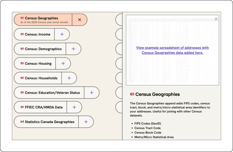
You can download an example of the results when you add Census blocks, tracts, and FIPS codes to a list of addresses here. You can test with one address here, no signup required.
Geocodio returns data for the most recent Census year by default, but older Census vintages are available. Currently, the most recent year is the 2025 Census year. Historic Census data back to 2000 is available through the API or by using the drop-down menu in the spreadsheet geocoding tool (example below).
How to get FIPS codes for historical Census years
Geocodio can give you Census FIPS codes for Census years 2010-2025 as well as 2000.
You can append the following Census years to addresses or coordinates:
2025 Census
2024 Census
2023 Census
2022 Census
2021 Census
2020 Census
2019 Census
2018 Census
2017 Census
2016 Census
2015 Census
2014 Census
2013 Census
2012 Census
2011 Census
2010 Census
2000 Census (only County, Place, Tract and Block FIPS codes)
What's the difference between GeoIDs and FIPS Codes?
FIPS Codes and GEOIDs are the same thing—in some circumstances. Some federal datasets report data at the "GeoID" level, while others use the term FIPS Code. GeoIDs are concatenations of various levels of FIPS codes, depending on the dataset. GeoIDs, or FIPS codes, can be up to 40 digits. The more digits there are, the more granular of a measurement it is. In order to connect government datasets to one another, you often need to use FIPS Codes or GEOIDs, so it's important that you use the right FIPS Codes and GEOIDs.
Geocodio returns FIPS codes, which can be matched to GeoIDs.
Let's use 580 Meyers St, Kettle Falls, WA 99141 as an example:
| If your dataset gives a GeoID of this length... | ...it translates to this combination of FIPS codes | Example GeoID | Geocodio Result Name |
|---|---|---|---|
| 2 digits | State | 53 | State FIPS |
| 5 digits | State + County | 53065 | County FIPS |
| 11 digits | State + County + Tract | 53065950101 | concatenate County FIPS + Tract Code; pre-concatenated for spreadsheet uploads as "Full FIPS (tract)" |
| 12 digits | State + County + Tract + Block Group | 530659501012 | concatenate County FIPS + Tract Code + Block Group |
| 15 digits | State + County + Tract + Block | 530659501012022 | concatenate County FIPS + Tract Code + Block Code; pre-concatenated for spreadsheet uploads as "Full FIPS (block)" |