Guides
for everything Geocodio
Guides
What happened to counties in Connecticut?
Guides
for everything Geocodio
What happened to counties in Connecticut?
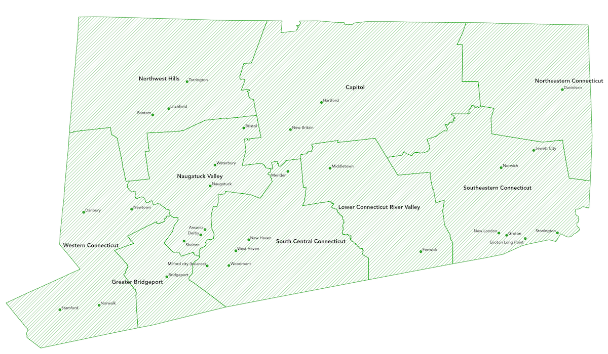
As of 12/1/2022 Geocodio now returns county-equivalent designations based on Connecticut's 9 Councils of Government for the "county" value in API responses and for processed spreadsheets.
Why was this change made?
Almost all functions of county government were abolished in Connecticut in 1960. Due to this, Connecticut has decided to officially migrate from using legacy County designations to county-equivalents based on Connecticut's 9 Councils of Government for statistical purposes.
You can read more about this change here: https://www2.census.gov/geo/pdfs/reference/ct_county_equiv_change.pdf
What are the county-equivalent regions?
Capitol Planning Region
Greater Bridgeport Planning Region
Lower Connecticut River Valley Planning Region
Naugatuck Valley Planning Region
Northeastern Connecticut Planning Region
Northwest Hills Planning Region
South Central Connecticut Planning Region
Southeastern Connecticut Planning Region
Western Connecticut Planning Region